Tagaytay Highlands
BECAUSE OF its cooler climate and fresher environment, Tagaytay is considered the closest alternative to the temperate climate of Baguio. It is frequented by visitors from Manila who are mainly reatreating from the polluted air of the city. The town’s focal attraction is the presence of this miniature-like volcano that is sitting in the middle of Taal lake. According to history, its bizarre location evolved from its huge eruptions that created a crater lake then another crater lake within that lake and another lake within that crater and it, as well has a small island. Widely known as the smallest volcano in the world, Taal Volcano is a scenic view that can be seen from the stretching slopes of Tagaytay highways elevated at 2500 ft. above sea level.

Taal Volcano Crater
Trekking up to the volcano crater is a worthy experience. Many guided tours are oftenly operated by resorts nearby. Though if you want to go without them, the best access is from Talisay. Bancas are available for transfer up to the island where horses also are chartered for tourists who may hesitate to walk up to the crater. The uphill hike takes about1 hour. Bring enough water, wear comfortable shoes and expect strong dusty winds throught out the hike. The water can be rough in the afternoon, so it is best to depart in the morning. Be aware, however, of those people that may run after your cars offering boat rides or trekking guides. They are nuisance and may only cause you troubles and lose of time. It is always advised to go there with ample information of the place and activities to do.

Cable Cars at the Tagaytay Highlands
For experienced mountaineers planning to head further deep into the volcano crater, be cautious of the hot surroundings and its sulfuric emissions from the steam vents. The hot water of the crater can cause severe skin irritation due to its high concentration of harmful chemicals. And last but most importantly, the volcano may look peaceful from a far but don’t forget that it can erupt anytime. To avoid traffic in the narrow highways of Tagaytay and clogged parking areas on weekends, visit the place during the week.

Relax at Sonia's Garden
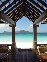
Tagaytay is a peaceful getaway from the fast lanes of urban life. Its cool natural ambiance yields an abundant display of fruits and vegetables mostly seen along the highway or at the busy market of the town.
To get there, via south super highway, exit to Silang and follow the signboard to Tagaytay. The highway heads straight to Tagaytay City. It is a preferred route because of lesser traffic.