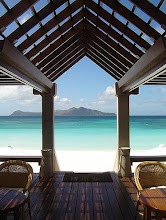
Manila Bay today
LONG BEFORE Philippines was Christianized by the Spaniards, Manila and surrounding districts were peopled by Muslim communities. The banks of Pasig River extending up to Manila Bay have a small settlement of locals carrying an active trade with Chinese and other foreign merchants.
When Legazpi arrived in 1571, he defeated the corps of Rajah Sulayman who was then the muslim ruler of Manila, and built a European-style walled city intended only for the Spaniards. Natives were removed elsewhere and Chinese were required to live within gun range.
The original wooden posts were replaced by massive tufa walls and in 1609 a moat was added. During the period of the Americans, the water-filled ditch was drained for health reasons.
In 1762 the British took over Manila but were ejected after two years. The Spanish realized that Intramuros was not invincible thus, consequently moved outside the walls. In 1863, a huge earthquake wrecked the General’s Place. The seat of government was then relocated to Malacanang.
At the beginning of World War II, Manila was a battle ground. To spare the district from severe destruction, General MacArthur moved to Corregidor but, when they returned in 1945, their bombs reduced more the previously devastated walls and turned the buildings into ashes. When the war was over, Manila was a dead city.
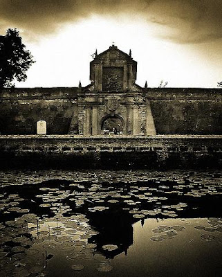
Intramuros (The Walled City)
The United States granted the country its full autonomy in 1946 but the city did not spring back to life. For many years, the city became an enormous wasteland overrun by squatters and depots. Container trucks roared through devastated streets, further damaging the ruined buildings and endangering the foundations of other centuries-old establishments.
In early seventies, despite the lack of funding, vast restoration projects of the walled city were implemented. Manila Cathedral was rebuilt and the Governor’s Palace has been reconstructed.
Intramuros slowly progressed and not long ago was transformed into a district of antiquity expositions, cafes, and a good nightlife destination.